Categories
2016 Target

Week 19

Ride 1 – Watershed moment

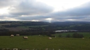
I set out with no real plan in mind, except to ride some local roads I hadn’t tackled in a while. So Hamsterley to Wolsingham, I rode Shull Bank, rather than my usual Howlea Lane route. I reached Frosterley and cycled Hill End up to Bollihope Moor and surprised myself by turning left towards Teesdale taking the harder and higher route. Over the watershed into Teesdale I was enjoying the long descent and deciding where I’d go when I reached the river at Egglestone, when I spied the road over the top to Middleton. I hadn’t cycled the first two-thirds of the road before, so i took it on. There’s a 150-200ft kick up when you first turn off, after that it’s a largely quick downhill to Middleton. I stopped for coffee and perhaps the 3,000ft of climbing already achieved meant my 20 miles felt like much more.

Fortified by cyclist staples of coffee and flapjack, I was soon cruising through Mickleton, Romaldkirk, Cotherstone and Lartington to Barnard Castle. Alas those extra ten miles didn’t warrant a second cafe stop, so I ploughed on. I wanted to try Dent Gate Lane, a climb I had tried only once three years ago just weeks after I’d bought my road bike. The experience scarred me and it was a demon that needed to be slain. Passing the GlaxoSmithKline works at, just before the turn I needed to reach Dent Gate Lane, I realised that I was at the start line for the Etape Pennines and I hadn’t climbed to Folly Top from this direction for two years. I headed on, knowing I could turn to Dent Gate from Folly Top. No PBs on the charge up, showing just how much sportive adrenaline can enhance performance, but I gave it a good go.

A rest on a sun-blessed grassy verge at Folly Top did less than coffee and cake would to replenish my energy store and I descended to Dent Gate Lane feeling less than prepared. I needn’t have worried – even in that state I took more than a minute off the climbing time.

From Copley i decided to call it a day and head home. I’d climbed more in 45 miles than I did in 81 at the Etape Caledonia last week and that event was still taking its toll. Getting home added another, slow eight miles. Slowest average speed on a ride for a while, but climbing, virus and post event recovery taken into account, still a ride to be proud of.

Ride stats: 53.1 miles; 4,594 ft climbed; 04h 01m 53s


Ride 2 – much needed leg stretch

This ride was to make sure I didn’t miss the weekly target for the first time, so I dragged the bike out kidding myself it was a recovery ride. I chose a little circular route and as soon as I knew I’d make the target, I headed home.

Ride stats: 7.4 miles; 543 ft climbed; 00h 32m 13s
Week’s total: 60.5 miles; 5,037 ft climbed; 04h 34m 06s

Categories
2016 Target

Week 18

A big week with the Etape Caledonia on Sunday, the first proper test of the year. And right on cue I picked up a virus that left me feeling decisively under the weather and knocked my pre event plans.


Ride one – Riding round the storm

Bank holiday Monday evening with a sky that looks glorious and threatening in equal measure. I set off, the only aims in mind to do at least an hour and avoid getting wet. I headed north, with the aim of cutting across in front of the squall that was coming down the dale, but it was moving fast and I cut northwest to see if I could out smart it, if not out run it. I found myself on glorious cycling roads I’d never encountered before and suddenly at the foot of Billy Row bank, which I had. Is it best to know what’s coming, or remain blissfully ignorant?  The climb through Billy Row goes in three sections of ever-increasing steepness and knowing what my opponent had to throw at me made the ride easier.

The squall passed behind catching me with only a few spots of rain and from the glorious descent toward Willington, I could see its damp grumpiness tracking down the other side of the valley. I chased it to Hunwick and chickened out when I crested the hill above Toronto to see the village being given a good soaking just a mile away. I headed back over the tops agreeing that a few hundred feet more climbing was a price worth paying to stay dry and into the village the back way.

Ride stats 18.2 miles 1206 ft 01h 15m 11s


Ride two – Etape Caledonia

The cold virus had left me with a very mucky chest, a hacking cough and very low energy. I slept loads on saturday when we arrived in Perthshire and felt surprisingly good eating my porridge on the hotel balcony at 04.30am. We arrived in pitlochry and were ushered straight up to the start line. We were away.

I was riding with my sister, who took up cycling last year. The caledonia was taking place on her birthday and back in the autumn buying her entry seemed a good present. What a way to celebrate!

The Caledonia is an 81-mile route through highland Perthshire, starting and finishing in Pitlochry. The air was gorgeously cool and heavy with moisture, which helped my breathing as we tracked westward along the northern bank of Loch Tummel and Loch Rannoch. There was a great camaraderie on the roads, chatting with other riders and getting cheered on by residents and supporters helped at every turn. After the second feed station everyone’s thoughts turned to Schiehallion, the biggest climb on the route. A few minutes into the climb, we stopped to help a rider who lost her balance and took a tumble. Sorted her bike and chain, and got her going again. The main climb was a slog, but not exceptional – it looked far worse on the elevation profile.

We were piped into feed station 3 and set off knowing we’d topped out for the day.

The weather in Glen Tay was warmer and brighter, the air drier and my chest began to suffer. It had been six hours and 70 miles since my Lemsip. We took a decent break at feed station four, but shortly after I was struggling and had to stop. I told my sister to go on and she told me not to be stupid – we were doing this together.

Five miles on, the final climb was a short, sharp kicker and we knew it was coming, so we stopped again to let my chest relax again. The final run in was a glorious ride in the sunshine. The 80 miles sign told us we had just one mile to go and we raced up into town to the finish line.

A brilliant experience. Residents, volunteers, organisers and fellow riders all made us feel very welcome. I hope we’ll be back.

Ride stats 80.9miles ; 4,016ft; 05h 22m 59s

Week’s total: 99.1 miles; 5,222 ft; 06h 38m 10s

Categories
2016 Target

Week 16

Summer might be here. Or is that just wishful thinking?

Ride 1 – Folly Top in the sunshine

Bright sunshine hitting the Dales was the perfect opportunity to stop driving the desk for a couple of hours and get out riding the bike. It wasn’t all pleasure though, I had the painfully tough task of testing and reviewing Fabric’s cageless water bottles. I set off and leaving the village, caught up with a rider who was out for a midweek spin “while my wife is out shopping.” We talked about routes and problem spots in the area for six or seven miles bimbling our way up to one of the higher villages in the area where, his allotted time nearly up, we parted.

I made my way up toward the watershed with Teesdale. It’s a steady climb through the hilltop village of Woodland to Folly Top and I enjoyed every turn of the pedals. The sharp blue sky and warm breeze felt deserved after so many dank winter miles. Shorts and short sleeves. Summer mits. I’m definitely a fair weather cyclist at heart. Isn’t everyone?

At Folly Top
At Folly Top

The roads that join on Folly Bank at Egglestone are a real intersection of highways. A rural intersection. Of countryside highways, granted. But a major intersection nonetheless. Choices are Barnard Castle and Bowes, Middleton-in-Teesdale and Alston, Brough and Kirkby Stephen, Stanhope, Bishop Auckland (the way I’d just come) and Staindrop and Darlington. I’d had in mind to have coffee at the cafe in Egglestone Hall Gardens. The cafe there is a favourite with local cyclists and one I’d never visited, but an unusual easterly wind had helped me up the bank a good deal faster than I was expecting, so I turned towards Staindrop.

It's a long, long road without any winding turns
It’s a long, long road without any winding turns

There’s a long descent from Folly Top to Staindrop and in the glorious sunshine it was no less enjoyable for being into a headwind. In the entire seven or eight miles, I was passed by three vehicles. One of those a tractor. I was getting used to the cageless waterbottles, like you do with clipless pedals when you first get them, I was practicing taking and remounting the bottles as I was pedaling along. Then I hit a bump and one went flying – a rookie error in putting it back on the clips – so had to stop and get it from the roadside.

Coffee and flapjack at The Laurels Cafe in Staindrop – I can heartily recommend it – gave me a quick boost before heading home around Ingleton and Bishop Auckland.

Ride stats – 38.4 miles; 1676 ft; 02h 24m 54s


Ride 2 – The Laurels again

Quick Sunday morning spin to make up my miles for the week. Out round the Bishop bypass and over to Ingleton. Down to Staindrop for coffee and cake at the Laurels. Twice in one week? Who’s counting!! Straight back along the A688 past a resplendent Raby Castle and its herds of grazing fallow deer to West Auckland and up Etherley Bank on the A68 before taking the back route home.

GPS stopped recording outside Raby, so I added the 10 miles home, but no extra climbing hence the odd figures.

Ride stats: 26.7 miles; 622 ft; 01h 04m 32s

Week’s total: 65.1 miles; 2,298 ft; 03h 29m 26s

Categories
2016 Target

Week 15

Two rides this week, but one hardly counts, because I cut it short in a hailstorm of mythic proportion not even a mile out of the village. So no report for that one.

Ride 1 – No fun riding in a hailstorm. Maybe later

Ride stats: 1.3 miles; 128 ft; 00h 09m 01s

Ride 2 – Fair weather cyclist

An early start nearly faltered in the same place as yesterday’s ride, because I’d forgotten my helmet. As a baldy that’s notmally an easy thing to notice, but it was only 4° outside, so I was wearing a skull cap. So having climbed the hill I turned back home to fetch my lid.

The 10-12mph westerly made for easly riding towards Bishop and I headed straight through town and out on the bypass towards Shildon. I had no plan in my head of where to go, but I wanted to get through the first half hour with the wind, so my legs got going, so I kept going East.

The road up towards Shildon has a cycle lane right next to it, but it’s the safe routes to school type and, as is common in county durham, it’s littlered with broken glass, bits of metal and other rubbish from the road. I stayed on the main carriageway and got a couple pointed of reminders that it was there from motorists climbing the hill on the road’s   w-i-d-e carriageway.

A right turn took me up Bruseelton bank and past Brussleton Incline, the route of one of the first railways in the country, on my way to join the Roman road at Royal Oak. The road runs straight down through Piercebridge to Scotch Corner and drops nearly all the way. So quickly after I found myself in Melsonbly, munching flapjack and plotting a route to Barnard Castle.

I needed 60 miles from the ride to make sure this wasn’t the first week of the year I failed to make target – so apart from mechanical failure, I was going to keep going all day, if I had to – and wanted to have hit 25 before turning to Barney, but I was sitting on 20. I’d have to do some route wiggling, if I was going to make 60.
Into the wind I headed for Forcett and Caldwell before pickjng up NCN 165 and followed it across the old suspension bridge at Whorlton and all the way to Barnard Castle.
Espresso, flapjack and some water at No 3 cafe got me ready for the homeward trip. I needed to find 25 miles from an 18 mile trip.

I retraced my path to the top of Whorlton, then broadly followed the W2W back to Bishop. A quick loop round south church and I thought I had enough to head straight home.
Ride stats: 60.8 miles; 2,374 ft; 04h 06m 40s

Week’s total: 62.1 miles; 2,502 ft; 04h 15m 41s

Categories
2016 Target

Week eleven

It’s getting to that time of year when I’m not sure what to wear out on a ride. The difference of a few degrees can mean the difference between freezing and sweltering. And its far to cold to be stopping to remove a layer if the latter is the case.

Ride 1 – Some easy midweek miles – no need to rush

It was on the last and steepest of the big climbs looking down at my GPS bumping along at 4.2 mph that I named the ride. This was hill chasing at its best.

Work done, it was 3pm when I set out and the cloud was low over the hilltops. I took my regular climb into Hamsterly and then down across Bedburn Beck at Howlea. I was last here in January on the mountain bike, so the climb up to the top would at least be quicker today.

Cycling climbs are categorised according to difficulty. There’s a range:

Category 1 - From 8km at 8% to 20km at 5%
Category 2 - From 5km at 8% to 15km at 4%
Category 3 - From 1.5km at 10% to 10km at 5%
Category 4 - From 2km at 5% to 5km at 2/3%
Category 5 - Greater than 500m at 3%

Because the French own cycling they have another category HC for Hors Catégorie or beyond categorisation. What you might call RRLS. Really Leally Long and Steep.

At the top of Howlea Lane, the view over Weardale is worth every pedal stroke.

I’m lucky to have a cat 3 climb so close to home – 2 miles at 5%. It’s nice to dash up and over on a warm summer evening. In the dank of winter, it’s always harder. And to get there, I’ve got to warm up on a cat 4 – 3% for 1.5 miles. So I don’t have to chase very far for hills.


At the top of Howlea Lane, the view over Weardale is worth every pedal stroke and there’s the excitement of Wear Bank to look forward to: A descent of 500 ft in just over a mile. Woosh! Don’t enjoy yourself too much though there’s a sharp turn at the bottom followed by another onto a bridge over the Wear.

Out of Wolsingham towards Tow Law the road strings two cat 4 climbs together, rising 400 ft in a mile then giving you half a mile off before climbing another 300 ft in another mile.

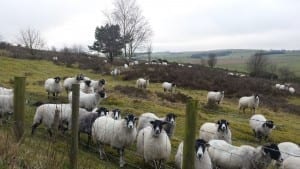
Mountain sheep on the flat

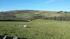
After the A68 there’s a nice long descent to Satley and turning right down Pan Lane it continues down to the bottom of the valley, where there’s an enjoyable roller coaster, big dipper ride over a bridge and back up the other side climbing just over 150 ft. Looking across the valley ahead of you, Headley Hope wildlife reserve looks wonderful. The wonder slowly turned to apprehension as I descended the 200 ft into the valley. The reserve slowly tilted in front of me to become a wall of scrub and heather with what had to be mountain sheep clinging to the near vertical surface.

Shaft of sunlight over Weardale

Boy, was it steep. I stepped up out of the saddle and pranced up around a slow right-handed bend. I saw the opportunity for a break, I mean a photo, half way up and instantly regretted stopping. It felt much harder to get going again and grind the strokes out up to the top.

Back along Headlyhill Lane through the wind farm to Tow Law and then a six-mile run back home down the A68


Ride stats: 24.8 miles; 2,262 ft; 01h 53m 42s

Ride 2 – Ride away from the hills. If you see a hill, ride the other way

I fancied a flatter ride than the one I had on Wednesday and the wind was up, so I headed out on the main roads around Bishop Auckland. Through Bishop’s picturesque market square and on out to South Church, before doubling back to join the A688. I put my head down and decided I’d go for a good average speed on the ride. On out through Evenwood Gate, then down through Esperley and up through Cockfield and Burnthouses to rejoin the A688 back into Bishop Auckland.

I was cycling directly into wind and it was hard going, but I had a target: a rider up ahead. It took much longer than I’d hoped to catch him. A victory that was short lived, because he overtook and kicked. I didn’t have the energy to go with him, but I pressed on as fast as I could.  I arrived home with a 16.5 mph average. My fastest ride of the year so far.

Ride stats: 27.9 miles; 1,230 ft; 01h 41m 40s

Week’s total: 24.8 miles; 2,262 ft; 03h 34m 22s

Categories
2016 Target

Week ten

Five whole days without riding left me with a big weekend gig and luckily the weather was unseasonably fabulous.

Ride 1 – Some new roads and a familiar route home

Riding the same roads all the time is getting the better of me. I’m sure I wouldn’t make a good regular cycle commuter. The sun was out and I fancied exploring some roads I’ve not cycled before; answering the question “I wonder where that lane goes.” So I did.

Model citizen - the locals have put a fake child walking a dog next to the road
Model citizen – the locals have put a fake child walking a dog next to the road

I took the quickest route into Bishop Auckland and out to South Church. There at the mini roundabout by the river is a road that climbs the hill to Auckland Park I know where it comes out, but I’ve never been up there before, so I went. The road passes under the railway and emerges by the roundabout at the bottom of the Auckland way. Just before I got tot he end, I turned right, taking the lane out to Coundon. In total the road climbs 300ft in just a mile and a half. Through Coundon a last-minute decision took me to along the A688 to Rushyford, passing two cyclists using the footpath on the way, and turning right through Woodham and past Aycliffe to Middridge and out through Shildon to Redworth.


Redworth village
Redworth village

At Redworth I took the back lane to Royal Oak on the A68. It’s a narrow, hedged country lane, but that didn’t stop a post van squeezing past me with millimetres to spare. I appreciate the man has a job to do, but I passed his parked van and son he was forcing past me again. Twice isn’t a joke, so as he was getting out of his van I shouted something polite meaning that I wouldn’t let him pass me again. He didn’t.


I crossed the A68 at Royal Oak onto the roman road that goes all the way down to Piercebridge and on to Barton. It’s a road I’ve wanted to cycle for a long time and I really enjoyed it, getting up t speeds of more than 40 mph on two occassions. I followed the road down to the B6279 and turned for Staindrop.

Raby Castle, hazy in the distance

I caught a guy out for a ride in the sunshne and rode along with him for a few miles chatting about training, this summer’s sportives and the weather. At Ingleton he suggested I motor on, so I did. I stopped to take photos of Raby Castle and he caught up. We rode into Staindrop together.

The Laurels Cafe in Staindrop

I had coffee and flapjack (how would I ride without them?) at the Laurels Coffee Shop on the green and made my plan to cycle straight back up the A688 to South Church again. From there I turned into Bishp and retraced my outward route home.


Ride stats: 41.0 miles; 2,049 ft; 02h 43m 55s


Ride 2 – The Bat

Sunny afternoon
Sunny afternoon
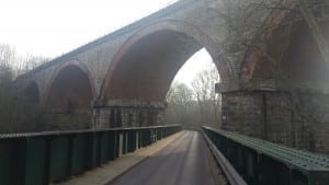
Bridge through a bridge, the rod bridge under the Wear Valley viaduct at Witton Park


Standard ride on a non standard day, he weather was beautiful. probably a minute or so faster than my last bat, because of the GPS failure that time.

Ride stats: 15.2 miles; 976 ft; 01h 00m 45s

Week’s total: 56.2 miles; 3,025 ft; 03h 44m 40s

Categories
2016 Target

Week eight

The end of February, week eight already! Two rides planned, then another squeezed in on Sunday, because it looked nice out. Furthest I’ve ridden in a week by a good way and the kind of distance I need to keep up every week through March and and on to September, if I’m going to meet my target.

Ride 1 – The bat

Second bat of the year. I use it as my measure of fitness. First one was in week five. Slow and cold it took very nearly and hour and a quarter.

This time, after swimming a mile in the morning, it took an hour. GPS missed a couple of hundred metres, so the stats are slightly out. I’ll give it a go again soon.

Ride stats: 14.9 miles, 891 ft, 01h 00m 21s

Ride 2 – Tow Law, Durham loop

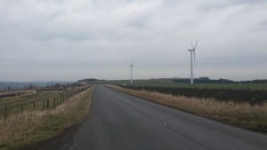
Wind turbines on Headley Hope Moor

Cold day and I was left with 25 miles to do for the week, so I headed out. Starting with a seven-mile, 700ft climb up the A68 to Tow Law, which I’m told is the highest town in County Durham. Then across a freezing Headley Hope moor watching dozens of majestic turbines turn slowly in the light wind. The view did nothing to warm me up and by the time I got down into Deerness Valley making my way towards Durham my thighs were numb with cold.

Top of Green Lane on the W2W

The seven or so miles from Cornsay Colliery to Stonebridge at Durham is a good, fast run. And the difference in temperature made riding tolerable again. For the first time this year, it felt like I was cycling quickly. Then Southwest on the A690 to Willington and through Hunwick to home. Bit of a scare down Green Lane, probably the steepest part of the Sustrans W2W route, at 40mph my brakes weren’t doing their job and I had a bit of a hairy moment bringing the bike to a stop before rolling out onto the A689.

Ride stats: 28.4 miles; 1,337 ft; 01h 54m 53s

Ride 3 – Pity Me loop

It was really sunny when I woke up on Sunday, so I got some bonus miles in. I used the opportunity to get on some roads I’ve not ridden before. So up to Crook and over to Deerness Valley via Billy Row bank – I knew there was a hill, butI wasn’t expecting it to be 530ft of pedal-grinding pain.

Broadgate Road climbing over to Langley Park
Langley Park from Hill Top

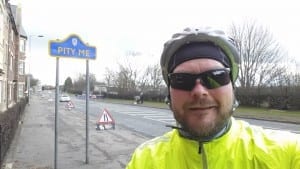
Then a 250ft climb over to Langley Park, made all the more interesting by an ignorant Iceland delivery driver and finally on the outward trip, a 300ft climb through Witton Gilbert to Sacriston and down into Pity Me.

An old mining village in Durham, not how I felt

A quick run on the A167 to join the A690 and back home using the same route from Stonebridge home as this week’s ride 2.

Ride Stats: 31.4 miles; 1,949ft; 02h 20m 51s

Week’s total: 74.7 miles; 4,177 ft;  04h 16m 05s

Categories
2016 Target

Week seven

I was away working in the first part of the week, so it was Thursday before I could get out on the roads. The days are still short and weather unpredictable, so I’ve kept my weekly target at 40 miles, 2,000 ft, and 3 hours in the saddle.

Ride 1 – Barney and back

Chilly and a decent westerly, so I decided on another 40-mile cafe run for lunch. The temperature was barely breaking 2 degrees when I left and a decent westerly was making it feel really chilly. I didn’t fancy the straight run into the headwind I’d get in Weardale, so decided to head to Barnard Castle over in Teesdale.

A quick run with the wind down to and around Bishop Auckland, then churning the pedals into the wind up the A688 and then down through Hilton toward Ingleton and the B6279 into Staindrop. A few miles west, a few miles south, a few miles west, and so on. Cycling south was easier, but colder than cycling west. From Staindrop down to Winston, then along the A67 for a few miles, then join the Sustrans W2W route south to Whorlton and west on to Barnard Castle.


Galgate in Barnard Castle

Barnard Castle is a gem in any weather and it looks stunning in today’s winter sunshine. I choose the cafe at The Witham – the town’s theatre and community creative centre – because it has covered, dedicated cycle parking and I know it serves seriously good coffee. All the tables are full and there’s a queue at the counter. I wait my turn ready to chuck my stuff on the first table that becomes free. As I’m ordering a family gets up leaving a table free and moments later a couple come in happy to see a free table. They make the mistake of looking round to check if anyone owns it and I catch their eye in a way that dares them to sit down – they don’t.

The Atrium at The Witham

My order of coffee, enormous flapjack, hummus and  roast pepper sandwiches, and a banana arrives – to the astonishment of the people at the table net to mine – and is delicious. I have another coffee as an excuse to staying the warm for a little longer, then head out into the cold. The sun has raised the temperature to a balmy 3.5 degrees.

Riding with the wind makes a massive difference to speed and warmth. My hands get uncomfortably sweaty in my lobster gloves, but better warm and sweaty then dry and cold. As much as possible I take different lanes on the route back, there are only a few miles of crossover. I’m happier adding some bigger climbs on the way back, so take the cross-country route through Evenwood and climb the steep bank to Toft Hill and hit my top speed for the day, 40pmh, on the A68 back to the village.

Ride Stats: 41.3 miles; 1620 ft; 2h 52m 31s

Ride two – Hell repeats

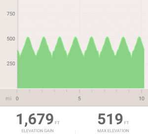
20160221_114028After last week’s post including Better than hill repeats, I had some comments that suggested I was wrong and should try hill repeats properly. So I did. I chose the hill in the village and challenged myself to climb it ten times in an hour. I failed.

A 210 ft climb over 0.6 of a mile. That would have meant 12 miles of cycling and 2,100 ft climbing in the hour. 14 and  a half minutes at the top of the second climb, I knew i wasn’t going to make it. It was a good power practise though and a good challenge to achieve at some point as I get fitter.

Ride stats: 10.2 miles; 1679 ft; 1h 06m 53s

Week’s total: 51.5; 3293 ft; 3h 59m 24s

Categories
2016 Target

Week six

The week started with the 8th of February. That was significant only because it’s three months until the Etape Caledonia, which I challenged my sister to ride with me when she bought her new Specialized bike in January. Riding suddenly gained a purpose other than the weekly mileage and height targets needed to get me to my 2016 target – I need to get fit enough not to disgrace myself with a performance poor in comparison to my little sis! So two new rides this week – one for distance and one for hills.

Ride 1 -Chatterbox run

It was a lovely morning and I planned to get going early, but it was very cold out and Durham Council’s brilliant weather cam service showed that the road and air temperatures in Weardale were hovering around freezing. My route up the dale uses back roads to avoid the A689 as much as possible, so I used the need to let the roads warm up as an excuse to stay at home for a while longer. I changed the plan from brunch in St John’s Chapel to lunch in St John’s Chapel.

Out of the village and up the A68 to Harperley to drop down into the dale proper. There’s a great view up the dale from part way down the hill and I always think “I should’ve stopped to photograph that,” as I speed past. This ride was no different. Good progress to Wolsingham where a Lafarge tipper truck needlessly overtook me on the sharp left bend on Durham Road bridge, then held me up through the town out toward the school. Grumble. Mutter.

Stanhope Square and Castle

At Frosterley the back road to Stanhope had been closed, because part of it had slipped into the Wear during one of the storms. Between Frosterley and Shittlehope the A689, in all its narrow, hedged bendiness, is less than pleasant for cyclists as cars treat it like a stretch of motorway. My hyper-vigilance relaxed as I rode into the warm and welcoming arms of Stanhope. Stanhope is a splendid North Pennines town and I don’t believe I’ve seen it look more splendid than it did in that bright winter sunshine. It took some considerable personal resolve to cycle on, rather than take refuge in an inviting cafe.

The Hills of Upper Weardale
The hills of Upper Weardale

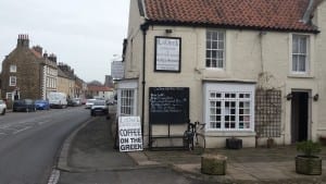
The ride from Stanhope to St John’s Chapel on the back road through Brotherlee is never an easy one. Into a cold headwind, the sharp climbs on this sometimes exposed lane made parts of it a torture. I ground out the six miles and 350ft slowly. St John’s welcomed me with a British Cycling banner draped across the gable end of my target destination: the fabulous Chatterbox Cafe. Today’s offer proudly displayed on the chalk board outside the door – FREE WARMTH – I ordered a double portion.

Chatterbox is a meeting point for locals, tourists and travelers alike. Dog walkers, cyclists, hikers, drivers, photographers, and twitchers among others frequent this friendly place. You’re immediately welcome and part of a hidden community. The food is delicious and the coffee and flapjack in plentiful supply. After a few minutes in the place you know the name is spot on.

It had taken me 1hr 44m to reach the cafe. I jumped back on the bike setting myself a target of an hour to get the 20 miles back home. The first 15 miles drop 600ft to Bradley, then a 275ft climb back up to the Harperly roundabout – I didn’t even think to look back to see if the photograph was still an option. I could see the minutes ticking away and knew I had to push hard to finish in an hour. And push hard I did, but in the end to no avail. When the Strava results uploaded the return leg had taken me one hour and one second. If it was high jump, the bar would have wobbled and fallen. It’s my target for next time!

Ride stats: 41 miles, 1651ft, 02h 42m 13s

Ride 2 – Better than hill repeats?

All the sportive training plans say riders should seek out a good hill for hill repeat training. A tough hill you can cycle up for at least two minutes before turning round, rolling to the bottom and starting all over again. I’ve done this before and I was thinking which of the many suitable local hills I should choose for this repetitive exercise when I wondered if I could achieve the same effect by stringing a few local climbs together. I set the target at 2000ft in 20 miles and an hour or so on Strava route builder later, I had my plan. Saturday morning was foggy to start with – not a time to be out on rural roads on a bike – with rain forecast for later, so the window was tight.

20 miles with specific climbs of 300, 100, 200, 250, 175, 120, 150, 250 and more gentle uphill. the wind was biting. When the rain started, it was so cold it stung my face. I reached home freezing cold and waited for the Strava results… only 1805ft climbed. The route builder had let me down – a lesson t be remembered in future.

Verdict? Riding a loop ismuch more interesting than hill repeats.

Ride stats: 20.4 miles, 1805ft, 01h 38m 25s

Week’s total: 61.4 Miles, 3,456 ft, 04h 20m 38s

Categories
2016 Target

Week four

Gale force winds left only one day that I could ride on this week, so I made the most of it

Ride 1 – In search of lemon top

I took the time to get the bike ready on Wednesday evening, so getting out on the road would be easy. I shoved two bananas and a couple of gels in the back pocket of my rain jacket and got going.

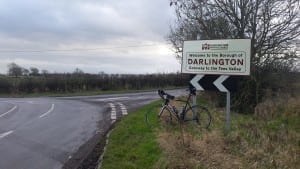
The first ten miles took me along the Wear to Bishop Auckland, then up Dene Valley 20160128_102709to Newton Aycliffe. The wind was strong and gusting more heavily than the 21 mph predicted by the forecast. As an hour ticked by I crossed the border from County Duham into Darlington Borough and started to make my way South and into the wind.

One of the many joys of riding is that on the back lanes you get to see things that you miss on car journeys. On this eight-mile windy slog, I’m treated  to Sadberge and Middleton One Row to picturesque little places that are a delight.


Sadberge
Sadberge
Assistance for the ailing cyclist in Sadberge
Middleton One Row overlooking the Tees


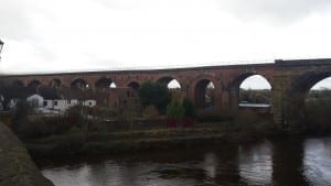
The railway viaduct over the Tees at Yarm

A welcome change in direction along the Tees sped me to Yarm and a stop for lunch at the wonderful cafe run by the inmates at HMP Kirklevington Grange. I first came across this place on a voluntary sector visit to the Prison in 2013 and was impressed. Kirklevington is an open prison with the purpose o preparing inmates for life on the other side of the fences. They run a number of enterprises including the cafe, a valeting service and sell garden ornaments, furniture and plants. My double espresso and barbecue chicken panini lunch came in at an unbelievable £3.90.

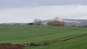
Roseberry Topping from five miles away
Roseberry Topping five miles away

Fired by lunch and caffeine my legs took me out of Yarm and up the Leven Valley. The new energy soon ran out as I climbed toward the Hills of the North York Moors National Park crossing the Leven and the Tame before joining the Leven again at Great Ayton. I turned left in the centre of Great Ayton to pass under the peak of Roseberry Topping – I’ve always thought that sounds more like the name of a pudding than a peak – which I’d been able to see for more than five miles growing slowly on the skyline.

I passed through Newton under Roseberry just after the 40 mile mark and my lack of long training rides was beginning to tell. I was grateful for the tailwind, which powered me onto a garage stop to fill the water bottles at Guisborough. The last six miles to Saltburn included three climbs that I felt were entirely unnecessary for a fat bloke at the end of a long ride, and I couldn’t wait to see the sea. I passed the Saltburn sign by Saltburn Golf Club and rolled on down to the clifftop by the upper halt for the cliff railway. It was closed for winter maintenance.

Ride stats: 50.4 miles, 1,674 ft, 03h 38m 12s

Week total: 50.4 miles, 1,674 ft, 03h 38m 12s